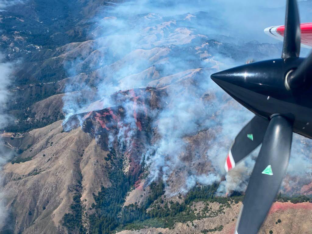
Wildfires and the rugged central coast have a long, exhausting history. When the Timber Fire sparked southeast of Loma Vista, it didn't stay small for long. Within hours, dry brush and punishing terrain turned a localized incident into a massive threat.
If you have trips booked or properties along the coast, you need to know where things stand right now. The blaze has scorched more than 1,723 acres and sits at a meager 5% containment. Mandatory evacuation orders are up, iconic landmarks are empty, and firefighters are fighting steep odds in the Los Padres National Forest. Meanwhile, you can read other events here: Why Zohran Mamdani's Millionaire Home Tax Exposes New York's Massive Ghost Car Problem.
The Ground Reality of the Timber Fire
The fire broke out late Saturday in an area that emergency crews dread. Steep canyons, heavy brush, and zero easy roads make direct attack nearly impossible from the ground alone. By Monday, the scale of the emergency became painfully clear. The fire exploded past 1,700 acres, fueled by weather shifts and bone-dry vegetation.
Containment remains stuck at 5%. Helicopters and air tankers are dropping water and retardant continuously, but heavy smoke and rugged geography limit what aircraft can safely achieve. To explore the bigger picture, check out the excellent report by Al Jazeera.
Iconic Big Sur Spots Under Evacuation Orders
When the Monterey County Sheriff's Office tells people to leave now, they mean it. The current evacuation orders cover vital zones along Highway 1, sweeping up world-famous tourist destinations and historic local institutions.
- Nepenthe Restaurant: The legendary cliffside eatery is completely shut down, with management and staff evacuating alongside locals.
- Alila Ventana Big Sur: The luxury resort sent all guests away to safety in Carmel and Monterey, suspending all operations indefinitely.
- Henry Miller Memorial Library: This cultural staple sits right inside the danger zone and has been evacuated.
- Esalen Institute: The historic retreat center also fell under mandatory evacuation orders as the fire pushed its boundaries.
Zones including MRY-F025, MRY-F026, MRY-F027, and MRY-F028-A carry active evacuation orders. Meanwhile, warnings stretch across neighboring zones like MRY-F023, MRY-F024, and MRY-F028-B, telling residents to pack bags and prepare to move at a moment's notice.
Highway 1 Closures and Travel Disruptions
Trying to drive through the coast right now is a bad idea. California Highway Patrol and Cal Fire have closed sections of Highway 1 to the general public. Checkpoints are active near the Point Sur Lighthouse and Vista Point around mile marker 37.5. Only emergency personnel and returning local residents with proper verification are getting past these points.
If you are a tourist holding reservations in the area this week, do not just drive down hoping for the best. Contact your hotel or rental provider immediately. Properties like Ventana are rerouting guest inquiries through corporate care centers, and cancellations or rescheduling options are standard protocol during active state emergencies.
What Comes Next for the Firefight
Incident commanders have requested specialized assistance, bringing in CAL FIRE Incident Management Team 1 to handle the growing complexity of the response. Ground crews are working frantically to construct containment lines along the Highway 1 corridor to keep the fire from jumping the highway and pushing toward the ocean.
Right now, no injuries or deaths are reported, which is the best piece of news in an otherwise grim situation. But with containment low and weather conditions shifting unpredictably, the battle is far from over.
Check official updates through the Monterey County Sheriff's office or monitor the local Genasys emergency mapping tool before making any travel plans to the central coast. Stay clear of emergency responders, keep local radio streams active, and obey evacuation mandates without hesitation.


