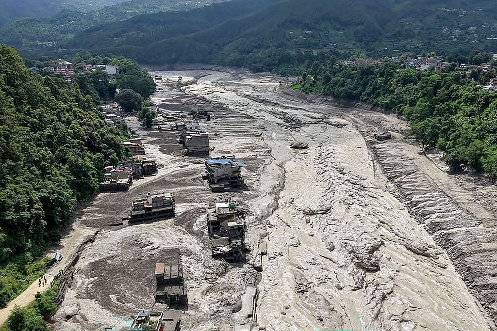
When a wall of mud and water slammed into Nepal's Bhote Koshi River corridor, locals faced a sudden, terrifying wall of destruction. Entire bridges vanished. Water levels in the Trishuli River surged by nine meters in barely thirty minutes. At first, scientists and emergency managers pointed fingers at the usual suspects. Was it a classic glacial lake outburst flood? Or an earthquake-induced tremor?
Turns out, the reality on the ground was far more complex. Researchers analyzing satellite data and seismic waves discovered that an enormous mass of ice and rock broke loose twenty kilometers northeast of the Rasuwagadhi border crossing. This ice-rock avalanche plunged straight into the Lhende River, creating a massive natural dam. When that temporary barrier inevitably failed, it unleashed a catastrophic flash flood that leveled infrastructure across Rasuwa district.
The Seismic Confusion
If you looked at early reports from seismic monitors, you would have seen a magnitude 4.4 earthquake flagged near Tibet. It is easy to see why automated systems jumped to conclusions. Ground-shaking often accompanies high-altitude disasters in the Himalayas.
The US Geological Survey later corrected the record. Long-period seismic wave analysis revealed that the seismic energy came entirely from a massive glacial collapse and the resulting debris flow, rather than tectonic shifting. They upgraded the event signature to a magnitude 5.2 equivalent based on the sheer force of moving ice and rock.
This mix-up highlights a major blind spot in early-warning tech. When millions of tons of frozen debris detach from a high-altitude slope, the earth shakes violently enough to fool seismographs. Emergency responders end up chasing ghost earthquakes while actual water surges down narrow mountain valleys at terrifying speeds.
Why the Himalayas Are Changing Fast
You can't talk about these disasters without looking at the broader climate pressures heating up high-altitude zones. Rising temperatures across the region aren't just a talking point for conferences. They actively destabilize steep mountain walls.
Think about what happens inside a glacier as atmospheric heat climbs. Internal ice melts, permafrost thaws, and the structural integrity of ancient rock faces degrades. When a slope loses its natural anchor, gravity does the rest.
According to joint assessments by groups like the International Centre for Integrated Mountain Development and the UN Development Programme, thousands of glacial lakes span Nepal, India, and Tibet. Dozens of these bodies sit in high-risk categories, acting like ticking time bombs above downstream communities.
The trouble is predictability. Researchers like Kathmandu University climate professor Rijan Bhakta Kayastha point out that while everyone knows the risks are growing, pinning down the exact timing or location of the next collapse remains nearly impossible. Cloud cover often blinds satellite monitoring systems for days at a time, leaving scientists flying blind just when they need eyes in the sky the most.
Managing the Threat Downstream
Real-time monitoring in rugged border regions requires coordination that crosses international lines. In the aftermath of the Rasuwa disaster, institutions like ICIMOD had to partner directly with Chinese agencies to piece together satellite feeds and video footage.
Downstream risks didn't end with the initial surge either. Chinese authorities soon flagged a secondary hazard near the confluence of the Chhochen Khola and Purepu Tsangpo rivers. A large barrier lake formed there, accumulating millions of cubic meters of water. As water began spilling over the natural crest, simulation models had to run constantly to figure out whether a full breach would wipe out communities further down the valley.
If you live, work, or manage infrastructure near high-altitude river basins in South Asia, relying on traditional seasonal flood schedules won't cut it anymore.
- Build continuous communication links with upstream hydrological stations.
- Upgrade local evacuation drills to account for flash floods that hit within minutes rather than hours.
- Factor ice-rock avalanches into structural hazard maps, moving beyond simple glacial lake tracking.