You signed a paper. Ink dried. Everyone exhaled. Then a sixty-meter limestone hump fifteen kilometers from the Israeli border turned back into a shooting gallery.
Ali Taher isn't just high ground. It commands Nabatiyeh, anchors the Iqlim al-Tuffah approaches, and holds eighteen years of ghost history from the pre-2000 Israeli occupation. When the Israel Defense Forces claimed "operational control" of the ridge and its concrete-lined tunnel networks in September 2026, the fragile summer truce didn't bend—it cracked.
Here's what mainstream reporting misses: paper frameworks signed in June didn't fail because politicians miscounted clauses. They failed because geography refuses political fiction.
The Trap of the Litani Line
Look at a topographic map of southern Lebanon. North of the Litani River sits Ali Taher, topped with its local religious shrine, honeycomb-drilled with Iranian-funded rooms, generators, and weapon stores.
Israel's position: no full withdrawal until total disarmament north of the river.
Hezbollah's position: no surrender of ground north of the river, period.
The Lebanese state's position: please take this hot potato before our civilian infrastructure dissolves into dust.
When Beirut suggested handing Ali Taher to the Lebanese Armed Forces, Hezbollah said no. Why? Simple military logic. Handing a ridge to a weak national army under Israeli shadow means losing it permanently without a shot. So the drone strikes continued, the air force hit Kfar Rumman, killing twelve people in early September sweeps, and the operational control claim became a PR and artillery anchor.
If you're tracking Middle Eastern escalations, stop looking at press releases about "framework compliance." Watch the ridges.
Why Ali Taher Matters More Than Beirut Real Estate
Military planners don't fight for views. They fight for lines of sight, electromagnetic elevation, and tunnel egress points.
- Elevation dominance: Rising roughly 600 meters, Ali Taher lets observers peer straight down into approach roads used for logistics.
- Subterranean depth: Israeli statements note command rooms, living quarters, and kitchens underground. Knocking out a surface footprint means nothing if the concrete box forty meters down stays intact.
- Asymmetric persistence: Hezbollah doesn't need to hold the summit with a parade-ground battalion. They need a quadcopter launch team fifty meters off the crest and a radio link.
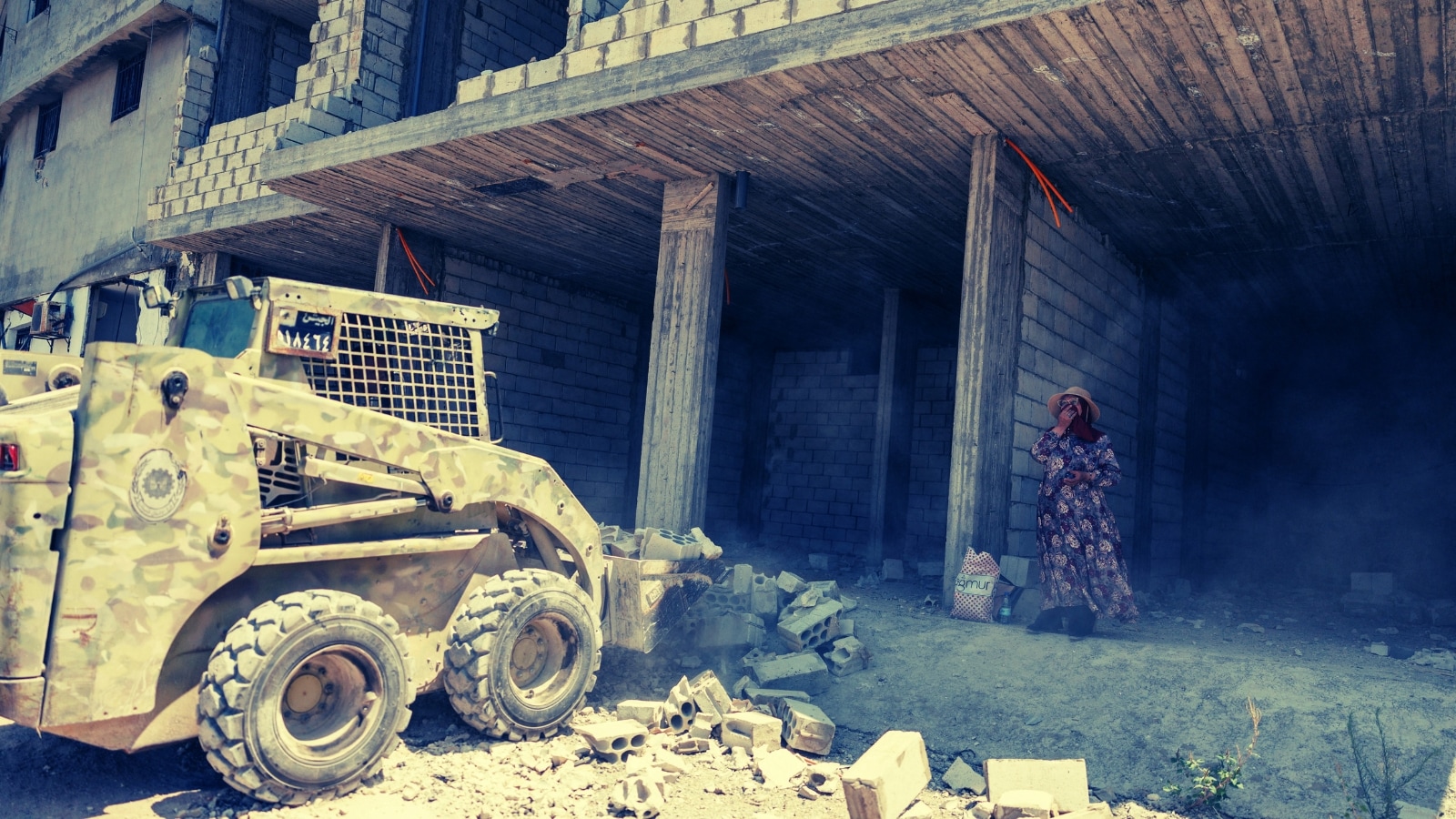
Israeli ground troops stepping onto the ridge invite sniper harassment and mortar bracket fire. Lebanese villagers in Kfar Rumman watch smoke curl from the crest while municipal leaders scream that high-level diplomacy is getting locals flattened.
The Disarmament Delusion
Everybody knew the June U.S.-brokered framework was a mirage packaged for television. Asking a non-signatory militia to fold its cards while hostile armor sits within binocular range is operational suicide.
Let's break down why the enforcement math doesn't work:
- The Lebanese Army constraint: LAF units act as a polite speed bump, not an occupational counterweight.
- The northern anchor: Hezbollah treats northern Litani territory as strategic depth. Give up Ali Taher, and Iqlim al-Tuffah becomes exposed.
- The retaliation cycle: A drone pops up near a patrol, a retaliatory jet flattens a residential slab in Kfar Rumman, casualties mount, and the diplomatic room clears out.
You cannot negotiate a demilitarized zone when one side views every contour line as survival territory and the other views it as an artillery correction dot.
What Real-Time Monitoring Actually Looks Like Right Now
If you're analyzing risk exposure for regional supply chains, security posture, or policy forecasting, throw out baseline "ceasefire holds" metrics.
- Track local Arabic-language municipality updates from Nabatiyeh province rather than central Beirut ministry wires. Central wires lag by 48 hours or soften casualty friction.
- Monitor kinetic frequency on secondary ridges near Beaufort Castle—friction points multiply the moment primary high ground gets contested.
- Ignore declarations of "operational control." Control of limestone tunnels means holding the hole, not breathing safely outside it.
Stop waiting for a grand diplomatic reset. Truces in southern Lebanon don't end with a signed treaty revocation. They bleed out one hilltop at a time.
Map the ridgeline. Watch the drones launch from the olive groves. Plan for friction that lasts years, not weeks.